Archaeologists from the University of Innsbruck have mapped a previously unknown Roman settlement in Lower Austria that may be the long-lost city of Claudivium.
Located near Stein/St. Pantaleon-Erla, close to the Roman military center of Lauriacum, the site was first associated with Roman activity decades ago. Systematic research beginning in 2017 has now revealed the scale and structure of the settlement.
A remarkably organized Roman community
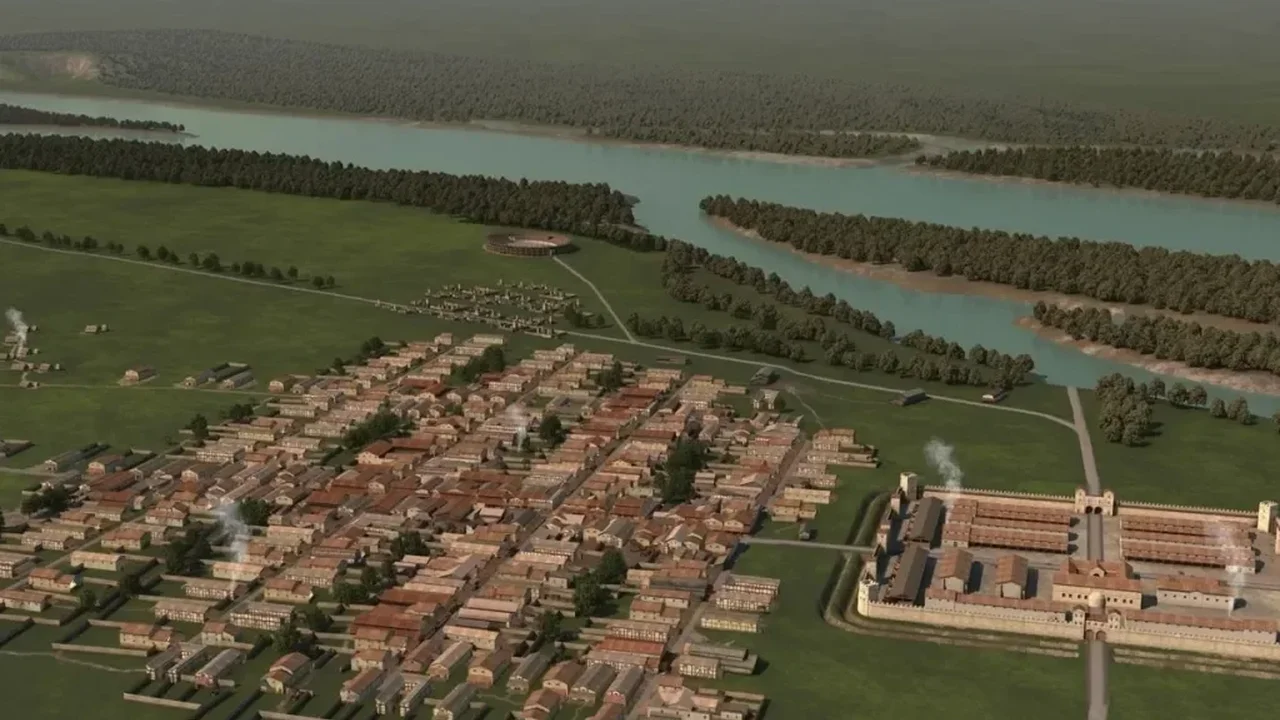
Non-invasive magnetic surveys and ground-penetrating radar identified a carefully designed town extending across roughly 25 to 30 hectares. Its orderly street grid, residential districts and an amphitheater designed for around 8,000 spectators point to an ambitious urban project.
The settlement developed beside a first-century Roman fort that housed approximately 500 soldiers. While civilian communities often emerged around such sites, researchers say the planned layout and exceptional size of this town distinguish it within the Roman Empire.
Evidence of a large cemetery and a possible brewing area further suggests that the community supported a lively local economy and a substantial population. The town appears to have been active from around 80 CE until approximately 180 CE.
Tracing a possible lost city
Researchers found no indication of sudden destruction, suggesting that residents may have relocated in an organized way as regional priorities shifted toward nearby Lauriacum. Shared bronze-working tools and garment pins offer clues to this movement.
The site's position closely matches coordinates recorded by the ancient geographer Ptolemy for Claudivium, although its identity has not yet been conclusively confirmed. Whatever its final name, the discovery offers a rare view of how Roman planning, commerce and community life shaped the Danube frontier.
This research could help redefine how historians understand the growth and movement of urban centers across Roman Europe.