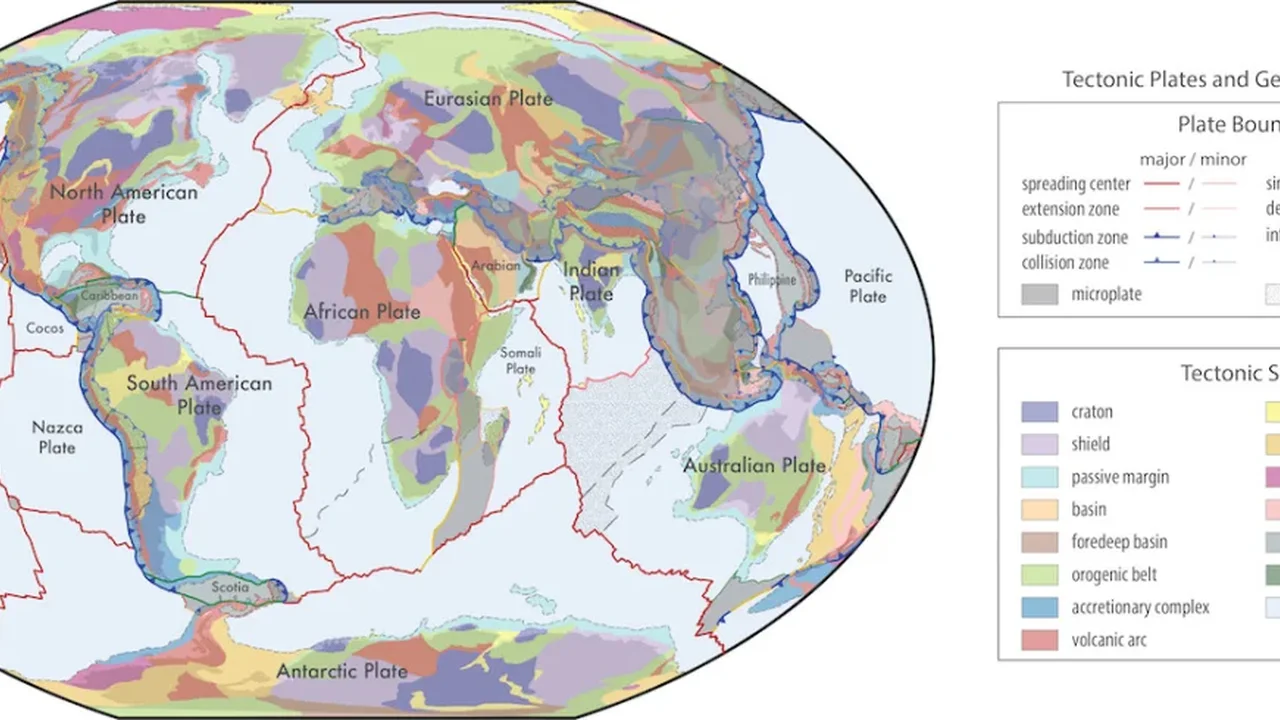
Earth's surface may look stable on a classroom map, but beneath that familiar outline lies a far more intricate system. An international team of geoscientists has created a global model that brings together plate motion, earthquakes, faults, rock ages and other geological evidence to show how the planet's outer shell is organized today -- and how it evolved over deep time.
Reading the planet in finer detail
The new framework treats the lithosphere as a dynamic mosaic rather than a simple set of large plates. It identifies 16 major plates, 54 microplates, 73 deformation zones and 899 geological provinces. Although microplates and deformation zones cover only a small share of Earth's surface, they account for a large portion of seismic and volcanic activity.
To build the model, the researchers combined existing regional and global maps with independent clues from GPS measurements, earthquake patterns, mapped faults, volcanic activity, gravity data, magnetic signatures and the physical properties of the deep lithosphere. The result is a more refined view of how crustal blocks fit together and move.
A tool for science and exploration
The compilation is designed as an open, updateable resource that can support research across geoscience. It includes two key products: a global map of geological provinces and a present-day plate-boundary model that can be extended back toward ancient tectonic history. Because the files are available in formats compatible with common mapping and GIS tools, scientists can test the boundaries, combine them with new observations and improve the framework over time.
Early applications are already showing its value. Researchers have used the model to interpret long-term GPS measurements in West Africa and to study why certain rare-earth-rich rock formations tend to appear near the edges of ancient continental cores. These examples suggest the maps can help connect modern motion, deep-time geology and resource research in one shared language.
Some regions remain less certain, especially where thick sediment, ice or limited field data obscure the bedrock. Even so, the model offers a strong foundation for future refinements. As more data is added, it could sharpen our understanding of Earth's structure, its mineral systems and the long story of continent building -- shaping the next generation of planetary science.