A research team led by Princeton University has produced the most detailed estimate yet of groundwater beneath the contiguous United States. The study calculates that underground reserves hold roughly 306,500 cubic kilometers of water--equivalent to around 13 times the volume of the Great Lakes.
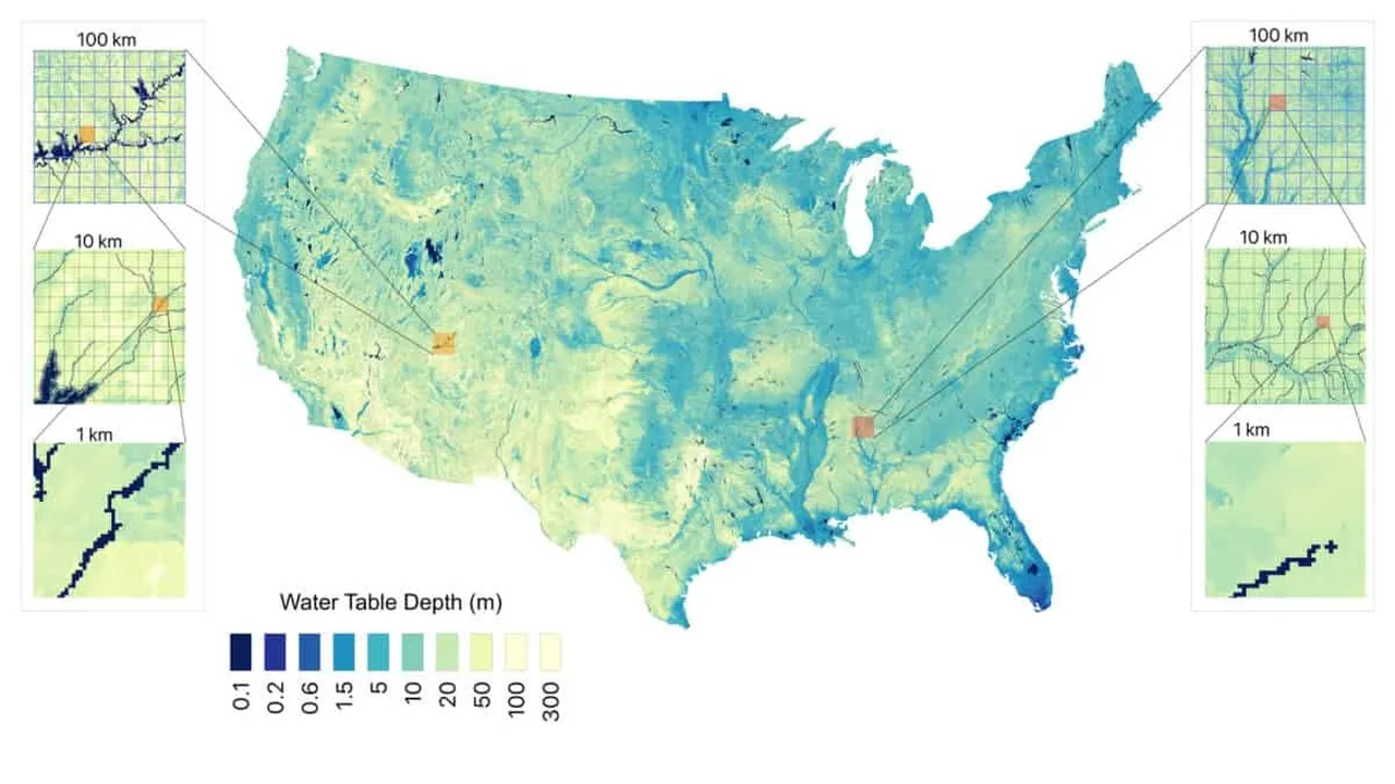
The new map examines groundwater down to 392 meters, the deepest level supported by reliable information about underground rock and soil structure. Built at a resolution of just 30 meters, it offers a far more localized view than earlier nationwide models.
A clearer picture beneath the surface
Groundwater is difficult to measure because it is stored in pores and fractures beneath the land surface. Traditional assessments have often relied on individual well records, which provide valuable but limited snapshots of conditions below ground.
To build a more complete national model, researchers combined nearly one million observations collected between 1895 and 2023 with data on rainfall, temperature, terrain, soil texture, stream proximity and underground water-flow characteristics. A machine-learning model then identified patterns across the landscape.
The findings show that approximately 40% of land in the contiguous United States has groundwater located within 10 meters of the surface. This shallow zone is especially important because it supports connections between vegetation, soils, streams and local ecosystems.
Useful insights for water planning
The map also demonstrates why detail matters. When researchers reduced their model to a much broader 100-kilometer scale, the estimated volume of groundwater fell by about 18%. Fine-scale mapping can therefore improve how regional planners, land managers and agricultural communities understand water availability.
By transforming scattered underground observations into a more coherent national resource map, the project creates a foundation for smarter long-term water planning. Such tools could help communities better align agriculture, ecosystems and infrastructure with the hidden water systems that shape daily life.
As data-driven environmental mapping advances, high-resolution groundwater intelligence may become an essential part of building more resilient landscapes and future-ready water strategies.