Researchers from the University of Utah have made a groundbreaking discovery: a substantial reservoir of freshwater lies beneath the Great Salt Lake, hidden beneath its salty surface. Their analysis reveals that freshwater fills sediments at depths ranging from 3 to 4 kilometers (approximately 10,000 to 13,000 feet). This finding was made possible through a helicopter-based survey conducted last year, which followed observations of freshwater surfacing under pressure in sections of the exposed lakebed in Farmington Bay, where unusual mounds covered in dense phragmites reeds were noted.
Lead author Michael Zhdanov emphasized that this study represents the first successful application of Airborne Electromagnetic (AEM) technology to detect freshwater beneath the conductive saltwater layer of the Great Salt Lake. The research team meticulously mapped the extent of the freshwater and estimated the depth of the water-saturated sediments by analyzing the underlying geological structure.
"We were able to determine the depth and spatial extent of this potential reservoir beneath the eastern lake margin," Zhdanov stated, a distinguished professor of geology and geophysics and director of the Consortium for Electromagnetic Modeling and Inversion (CEMI).
State-Funded Research on a Newly Discovered Aquifer
The findings were published in the journal Scientific Reports, affiliated with Nature. This research is part of a larger initiative led by the University of Utah's Department of Geology and Geophysics, funded by the Utah Department of Natural Resources, aimed at enhancing our understanding of groundwater beneath the Great Salt Lake, the largest terminal lake in the Western Hemisphere.
Contributions from senior faculty and graduate students have been vital to this ongoing project, which has already yielded two additional studies, with more anticipated.
The recent results suggest that freshwater is migrating into the subsurface towards the lake's interior, a deviation from the typical expectation of it remaining near the edges. Hydrologist Bill Johnson, a co-author of the groundwater studies, commented on this unexpected pattern.
"What surprised us was not the salt lens near the surface, but the extent of freshwater moving towards the lake's interior," Johnson explained during a recent interview. "Traditionally, we expect brine to fill the volume beneath the lake, but our findings indicate a significant volume of freshwater extending inward."
Freshwater Could Help Reduce Toxic Dust
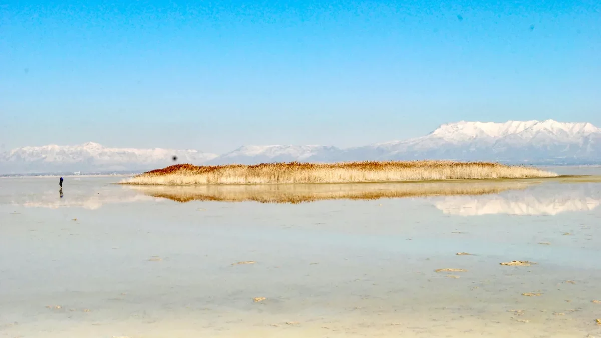
This research was prompted by the emergence of circular mounds on the dried lakebed in Farmington Bay, measuring 50 to 100 meters across and covered in reeds reaching about 15 feet high. As lake levels have declined, approximately 800 square miles of exposed lakebed have become a source of dust pollution affecting nearby communities.
Johnson and his team are investigating the potential of utilizing artesian groundwater to mitigate dust pollution, which contains harmful metals. "Understanding the beneficial effects of this groundwater is crucial before we consider extraction," he noted.
Airborne Surveys Reveal Subsurface Structure
Using airborne electromagnetic surveys, the researchers measured electrical resistivity to distinguish between freshwater and saltwater. A Canadian geophysical team conducted the survey in February 2025, covering 154 miles across Farmington Bay and the northern part of Antelope Island.
The data allowed the team to map the interface between freshwater and saline water underground, revealing a complex geological framework. Zhdanov expressed the need for comprehensive surveys across the entire Great Salt Lake to fully understand its hydrological dynamics.
Ultimately, this research could inform regional water management strategies and inspire similar studies aimed at locating freshwater beneath terminal lakes globally.